Mohave County, Arizona
Sell your land in Realsite Arizona Ranchettes for cash
Parcel Buyers buys vacant-coded lots in Realsite Arizona Ranchettes for cash, including one-acre homesites across seven recorded units. You receive a written, no-obligation offer within 24 hours, and an independent title company typically closes in about 10 days with no fees or commissions.
By Parcel Buyers · · Lot figures from the 2027 Arizona parcel and assessment data · How we made this page
Quick answers
- Who buys land for cash in Realsite Arizona Ranchettes?
- Parcel Buyers is a direct land buyer that makes written, no-obligation cash offers on vacant lots and acreage in Realsite Arizona Ranchettes, Mohave County, usually within 24 hours. Sales close through an independent title company, typically in about 10 days, with no fees or commissions to the seller.
- What did vacant lots in Realsite Arizona Ranchettes sell for in 2025?
- In 2025, vacant lots in Realsite Arizona Ranchettes sold for a median of $1,800 across 19 arm's-length sales; the middle half sold for $1,200 to $2,500.
- How many vacant lots are in Realsite Arizona Ranchettes?
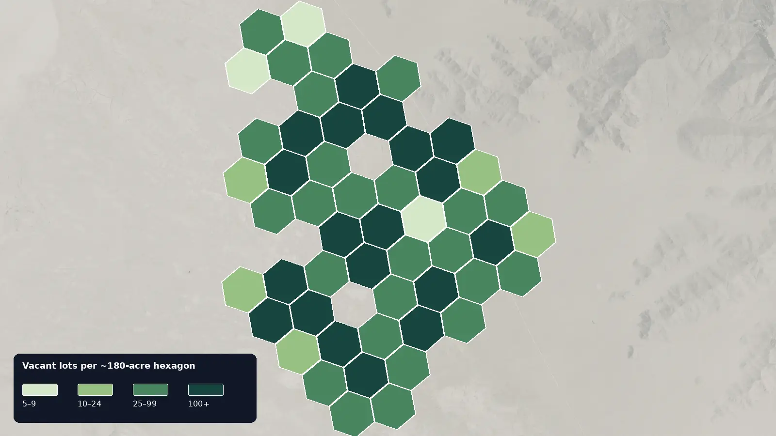
- The 2027 Arizona parcel and assessment data lists 4,546 vacant residential lots in Realsite Arizona Ranchettes; 52% are one-acre homesites, and the median lot is 1.05 acre.
- How is a cash offer for land in Realsite Arizona Ranchettes set?
- We start from recent sales of similar lots nearby, like the 2025 prices on this page, then adjust for water and sewer, road access, flood zone, lot size and any title issues, and for the time and cost of reselling. You get one written number, not a range.
- How do I know a land buyer in Realsite Arizona Ranchettes is legitimate?
- A real buyer closes through an independent, licensed title company and never asks you to pay anything up front. We never charge sellers a fee, deposit or closing-cost advance, and the title company pays you by check or wire at closing.
Local data
Realsite Arizona Ranchettes land at a glance
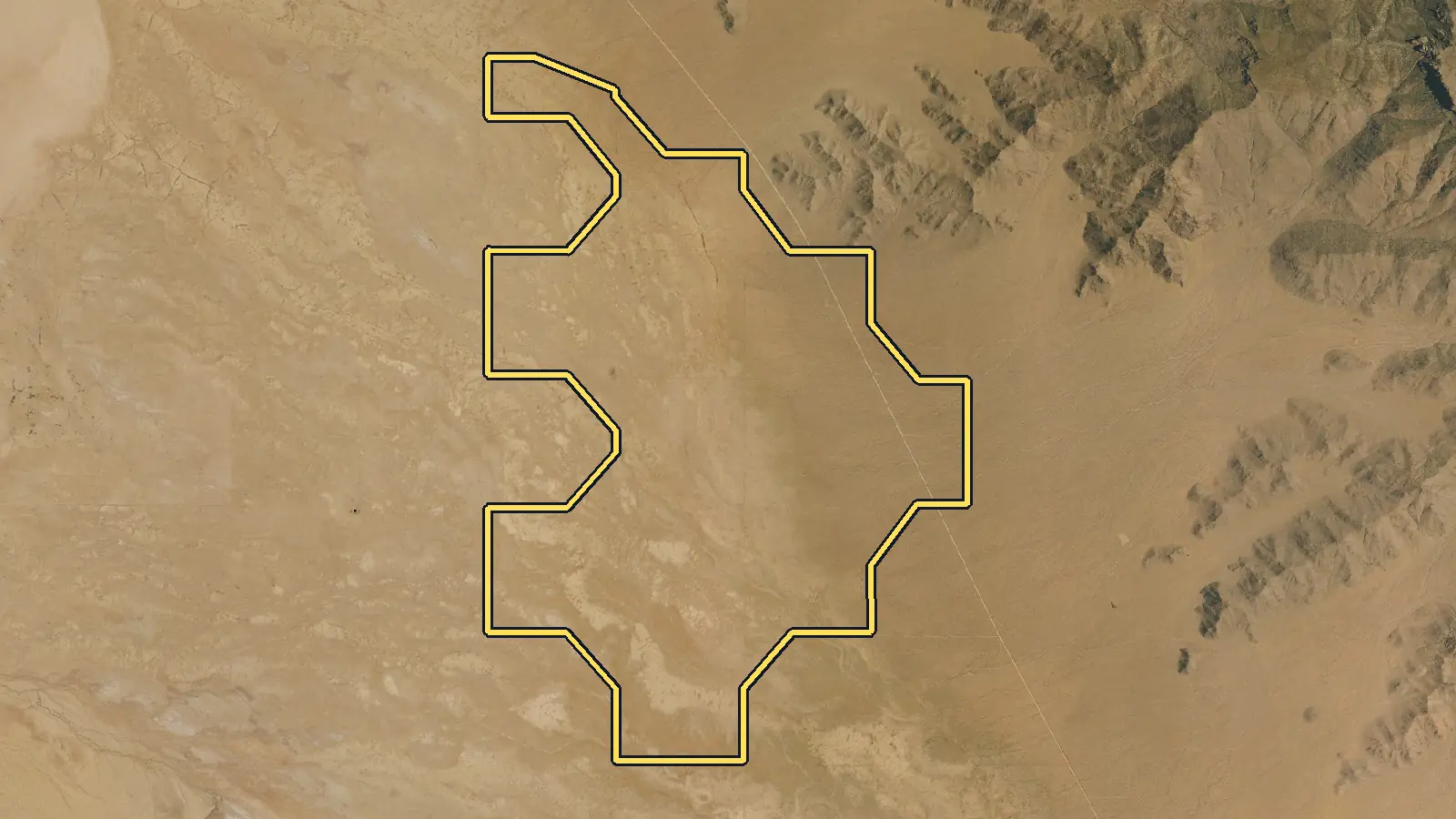
Tax-roll figures cover vacant lots whose legal description on the Mohave County Assessor's records names the Realsite Arizona Ranchettes subdivision (all units) in Mohave County. Local rules and services are sourced below.
| Vacant residential lots | 4,546 parcels classified vacant residential on the 2027 Arizona parcel and assessment data [1] |
|---|---|
| Most common lot size | One-acre homesite (40,000–46,000 sq ft): 52% of vacant lots; next, acre-plus at 40%. Median lot: 1.05 acre (45,740 sq ft). [1] |
| Typical county full cash value | $2,000 median county full cash value for a vacant lot; the middle half fall between $1,400 and $2,500 [1] |
| Recent lot sale prices | $1,800 median across 19 arm's-length sales of vacant lots in Realsite Arizona Ranchettes (Jan 2025–Dec 2025); the middle half sold for $1,200–$2,500 [1] |
| Owners who live elsewhere | 63% of vacant lots have an owner mailing address outside Arizona (most often NJ, NV, CA) [1] |
| Seven indexed units | Mohave County's subdivision index lists Units 1, 2, 3, 6, 7, 8 and 9, recorded in map books 335 and 341. [2] |
| County governs permits | Mohave County Development Services enforces the General Plan, zoning, land-division, FEMA and 2018 building-code rules for county projects. [3] |
| Septic layout numbers | County guidance uses 100 feet between a well and septic, a recommended 50-foot well boundary buffer, and a $518 conventional residential review fee. [4] |
| Road map categories | County GIS marks maintained paved roads, maintained dirt roads, non-maintained public rights-of-way and private rights-of-way as separate layers. [5] |
| Flood review timing | For a complete application, Flood Control states 10 working days for completeness and 10 for substantive review, with a 20-working-day overall frame. [6] |
| Interstate 40 | For one Unit 1 parcel, Mohave County gives the route as US 66, north on Antares Road, then west on Bermuda Drive. ADOT identifies the SR 66 and I-40 junction as Exit 54; other units and lots need their own route check. [8],[9] |
Data: Mohave County Assessor's Office, Pinal County Assessor's Office, Cochise County Assessor, Santa Cruz County Assessor, Pima County Assessor, Graham County Assessor and La Paz County Assessor. Counts, medians and shares only; no owner names, parcel numbers, addresses or row-level data are published.
Pricing
What is a lot in Realsite Arizona Ranchettes worth?
In 2025, vacant lots in Realsite Arizona Ranchettes sold for a median of $1,800 across 19 arm's-length sales; the middle half sold for $1,200 to $2,500. [1]
These are open-market sale prices. A direct cash offer is usually lower, because a cash buyer closes in days and takes on the time and cost of reselling the lot.
What moves the price in Realsite Arizona Ranchettes
One-acre geometry and unit map
Most of this assessor cohort clusters tightly around one acre: one-acre homesites account for 52%, and the median is 45,740 square feet. The county index nonetheless splits Realsite Arizona Ranchettes across seven listed units and two map books. Buyers need the exact unit and lot shape because a nominal acre can carry different road frontage, terrain, easements or setbacks. Size from the assessor does not reveal any of those conditions. [1],[2]
A thin but reportable 2025 sample
Only 19 records meet the sale rule here, so the price evidence is thin. The calculation uses the county's most recent recorded sale on lots still vacant, dated 2025, restricted to warranty or special warranty deeds with one parcel per deed. Its median is $1,800, and the middle half is $1,200–$2,500. That narrow result should not be treated as a full market survey, an appraisal or a promise about another lot. [1]
One acre leaves limited system spacing
Private utility design can use a meaningful share of a roughly one-acre parcel. Mohave County wants at least 100 feet between a well and septic system, recommends a 50-foot well buffer from the boundary, and requires another 50-foot property-line buffer for septic where public water is unavailable unless a recorded agreement applies. Those distances make parcel shape and neighboring systems relevant. A soil review and approved plan, not the acreage token, determine feasibility. [4]
Access and flood review before pricing
Map access and physical access must agree. Mohave County reports 859 paved maintained miles, 1,245 unsurfaced maintained miles and more than 8,500 miles of non-maintained public rights-of-way. It also reviews permit applications for flood concerns; work in a special flood hazard area can require a Floodplain Use Permit. A cash buyer weighs both layers, then inspects the actual route and site instead of assuming every recorded unit has the same conditions. [5],[6]
Common situations
Selling land in Realsite Arizona Ranchettes in these situations
The assessed value is only a nominal figure
County full cash value is not a sale price, and on this subdivision page it should not be used as a pricing shortcut. The filtered deed sample is separate and thin. Parcel Buyers instead reviews the unit map, title, access, utility path and site condition before delivering a written offer. You do not have to order an appraisal or pay for improvements before asking for that offer. [1],[2]
The deed uses an unfamiliar unit number
Unit numbers are normal in the county record for this subdivision. The index lists Units 1, 2, 3, 6, 7, 8 and 9; a missing number in that sequence is not something to correct by guesswork. Keep the legal description exactly as recorded when requesting an offer. Parcel Buyers closes through an independent, licensed title company. [2]
You want to close without coming to Arizona
A seller can close from another state. The assessor group shows 63% of owner mailing addresses outside Arizona; that is only a mailing measure. Electronic signing and mail-away documents are available, while the independent title company coordinates the deed and payment. Funds can be sent by check or wire, and Parcel Buyers covers closing costs without a commission. [1]
Step by step
How do I sell my land in Realsite Arizona Ranchettes?
From your first message to money in hand, with nothing left out. Requesting an offer costs nothing and commits you to nothing.
See every detail of the process-
Tell us about your land
Fill out the short form (about 60 seconds) or email us. A land specialist reaches out to confirm the details, usually the same business day.
-
Get your cash offer within 24 hours
We review the property and send a written, no-obligation cash offer within 24 hours. It is a real number, not a range. Take it or leave it, with no pressure either way.
-
Sign electronically
If you accept, everyone signs the purchase agreement electronically. There is nothing to print or mail at this stage.
-
We inspect, the title company verifies
Our team inspects the land and an independent title company runs a title search for liens or taxes owed. If the land does not pass inspection, you are never charged anything.
-
Close and get paid
The title company prepares the closing documents for notarization and issues your funds by standard check, overnight check, or wire transfer. A typical sale closes in 10 days.
Questions
Selling land in Realsite Arizona Ranchettes: common questions
Why is the 2025 sale count for Realsite Arizona Ranchettes so small?
The method is intentionally narrow. It keeps only the latest 2025 warranty or special warranty deed on a lot still coded vacant, requires one parcel per deed, and removes bulk-style deals. The remaining 19 records are enough to report a median but still form a thin sample.
Can Parcel Buyers purchase a lot with no utility hookups?
Yes. We buy vacant land without requiring water, sewer or road work. We check available utilities, legal access and title before offering, then inspect the property. Future well and septic approval remains a parcel-specific county and state process, not a condition the seller must finish first.
Does one acre guarantee enough room for well and septic?
No. County guidance calls for 100 feet between a well and septic system plus boundary buffers in certain conditions. Parcel shape, neighboring systems, soil and the proposed design can all matter. Only a proper site and permit review can determine whether a particular plan fits.
How do I check access to a Realsite Arizona Ranchettes lot?
Start with the recorded unit map and Mohave County's road and right-of-way layers. The county distinguishes maintained routes from non-maintained public and private rights-of-way. Then verify the physical approach, because a mapped right-of-way does not state current road condition or passability.
Must I resolve old taxes before accepting an offer?
Not necessarily. Mohave County says property taxes are due October 1 and that most bills may be paid in two installments; owners remain responsible even if they did not receive a bill. You can request an offer before paying the balance. With your consent, back taxes or liens can be paid from sale proceeds at closing.
Owner resources
Guides for your situation
- Selling Land With Boundary or Survey Problems
Land with a boundary or survey problem can still be offered for sale, but closing may depend on how the buyer, lender, and title insurer handle it. The contract and closing requirements determine whether a survey is needed. A fence does not by itself establish the record boundary. A survey can identify gaps, overlaps, occupation lines, and encroachments; a competing Florida title claim may require a quiet-title action.[1][6][7]
- Can You Sell Land With a Lien?
Yes. Land with a lien can often be sold, but signing a deed does not by itself erase a valid claim. The lien may need to be paid, released, discharged, or otherwise resolved under the law that applies. With the seller's consent, an approved payoff can come from sale proceeds at closing. If the balance or lien is wrong, dispute it before closing and require proof of the cure.
- How to Avoid Vacant-Land Seller Scams and Deed Fraud
Verify a land buyer and closing company through records and contact details you find independently, not links or phone numbers sent in an email. Never sign a blank or unexplained deed, pay an unexpected fee, or accept changed wire instructions without calling a trusted closing contact. Fake-owner scams use stolen identities and forged documents to sell land without the real owner's knowledge.[1] If money moved, contact the bank or transfer provider immediately and report the fraud.[2][3]
More places in Mohave County
Your written offer
Get your cash offer
Four short steps, about 60 seconds. We review your property and send a written, no-obligation cash offer within 24 hours. You can take it or leave it.
What happens after you send this
- A land specialist reaches out, usually the same business day, to confirm the details.
- You get a written cash offer within 24 hours: a real number, not a range.
- You decide. Requesting an offer costs nothing and commits you to nothing.
You will never be asked to pay us anything. No deposit, no processing fee, no closing-cost advance.
Nearby areas we buy
- Kingman
29,249 vacant lots · 2025 median lot sale $10,000
- Lake Mead Rancheros
6,454 vacant lots · 2025 median lot sale $3,000
- Valle Vista
4,633 vacant lots · 2025 median lot sale $7,000
- Mohave County
125,868 vacant lots countywide
How we made this page
Parcel Buyers is a land-buying company based in Florida. We buy vacant land directly from owners and publish these local pages so owners can see what land in their area is doing before they sell, to us or anyone else. We count the tax-roll figures ourselves from state data, take local rules and fees from the official sources listed below, and use AI tools to help research and draft the text. Every number links to its source, and we update the page when the data changes.
Method and sources
Parcel and assessment figures cover vacant lots whose legal description on the Mohave County Assessor's records names the Realsite Arizona Ranchettes subdivision (all units). Source [1] is our own aggregate count of public parcel records from the named Arizona county assessor. A place scope may be a ZIP area, assessor market area or normalized subdivision family; use the exact scope and do not treat it as municipal limits or a buildability finding. Vacant-lot counts use mohave: use codes 0001-0004 and 0011-0014, improvement value 0, non-exempt, positive acreage, with government and HOA owners excluded in-query. Pinal: use codes 0011, 0013 and 0014 with legal class 02RL, with government and HOA owners excluded in-query. Cochise: use_code 0011 or 0013 and accttype Vacant. Santa Cruz: IMPVAL=0 and LANDVAL>0, excluding county-owned, under-0.05-acre, and HOA records. Vacant nonresidential and agricultural parcels are not derived (0). Pima: parcel use 0011, 0012, 0013 or 0014 with positive GIS acreage. Graham: account type Vacant with positive GIS acreage. La Paz: property use code 13 or 14 with positive acreage. Government and HOA owners are excluded in-query in all three; because none of these three layers carries an improvement-value field, each county was screened with a seeded 150-centroid sample against the FEMA/ORNL USA Structures public layer (Pima 1/150, Graham 0/150, La Paz 4/150). Lot sizes use mohave PARCEL_SIZE acres; Pinal LANDSF square feet or STATEDAREA acres when blank; Cochise acres; Santa Cruz Acreage. Acre fields are multiplied by 43,560 and bucketed with the Parcel Buyers lot-size chart ([low, high) square feet). Values use county full cash value on the current record: Mohave FULL_CASH_VALUE, Pinal CNTASSDVAL, Cochise fcv and Santa Cruz FCV. These are assessor values, not sale prices or buildability findings. Pima full cash value (FCV). Graham and La Paz publish no value field, so their value row is withheld. Owner locations use owner mailing-address state on the county record; in_state = Arizona; blank state = unknown. Sale figures use each county keeps only a parcel's most recent sale. Mohave uses calendar-2025 WD/SWD records on one parcel per receipt. Pinal uses calendar-2025 W1/X records with unique date-and-price pairs. Santa Cruz joins calendar-2025 recorded sales to current clean parcels, keeps WD/SWD current deed types, $1,000+, one parcel per reception number, and prices no more than 10 times land value plus $20,000. These are conservative recorded-sale proxies, not verified arm's-length flags. Cochise has no free county sale-price source, so its sale rows are suppressed. Treat medians as a guide to county records, not as an offer or an appraisal. Page updated October 8, 2026.
Data: Mohave County Assessor's Office, Pinal County Assessor's Office, Cochise County Assessor, Santa Cruz County Assessor, Pima County Assessor, Graham County Assessor and La Paz County Assessor. Counts, medians and shares only; no owner names, parcel numbers, addresses or row-level data are published.
- [1] Mohave County Assessor's Office, Pinal County Assessor's Office, Cochise County Assessor, Santa Cruz County Assessor, Pima County Assessor, Graham County Assessor and La Paz County Assessor (data); Parcel Buyers (analysis), Arizona county assessor public parcel services (Mohave, Pinal, Cochise, Santa Cruz, Pima, Graham and La Paz) (accessed 2026-11-06)
- [2] Mohave County, Mohave County subdivision index: Realsite Arizona Ranchettes entries (accessed 2026-10-08)
- [3] Mohave County, Development Services (accessed 2026-10-08)
- [4] Mohave County, Septic and well permitting (accessed 2026-10-08)
- [5] Mohave County, County roads and public right-of-way (accessed 2026-10-08)
- [6] Mohave County Flood Control District, Floodplain permitting (accessed 2026-10-08)
- [7] Mohave County, Treasurer frequently asked questions (accessed 2026-10-08)
- [8] Mohave County, Planning and Zoning Commission Agenda Book, March 12, 2025 (accessed 2026-10-08)
- [9] Arizona Department of Transportation, I-40: Rancho Santa Fe Traffic Interchange (accessed 2026-10-08)