North Carolina
Sell your land in Cherokee County for cash
Parcel Buyers buys vacant lots and land for cash throughout Cherokee County, including mountain tracts that need septic, well, floodplain, watershed, private-road or title review. You get a written, no-obligation cash offer within 24 hours, and closings run through an independent, licensed title company, typically about 10 days after the purchase agreement is signed, with no fees or commissions.
By Parcel Buyers · · Lot figures from the 2026 North Carolina parcel and assessment data · How we made this page
Quick answers
- Who buys land for cash in Cherokee County?
- Parcel Buyers is a direct land buyer that makes written, no-obligation cash offers on vacant lots and acreage in Cherokee County, North Carolina, usually within 24 hours. Sales close through an independent title company, typically in about 10 days, with no fees or commissions to the seller.
- How many vacant lots are in Cherokee County?
- The 2026 North Carolina parcel and assessment data lists 12,140 vacant residential lots in Cherokee County; 21% are mini-estate (2-3 acres)s, and the median lot is 1.24 acre.
- How is a cash offer for land in Cherokee County set?
- We start from recent sales of similar lots nearby, like the 2025 prices on this page, then adjust for water and sewer, road access, flood zone, lot size and any title issues, and for the time and cost of reselling. You get one written number, not a range.
- How do I know a land buyer in Cherokee County is legitimate?
- A real buyer closes through an independent, licensed title company and never asks you to pay anything up front. We never charge sellers a fee, deposit or closing-cost advance, and the title company pays you by check or wire at closing.
- Which unit has the most records in Cherokee County?
- Section 2 is the largest published legal-description group in Cherokee County, with 239 records.
Local data
What is land in Cherokee County worth?
These are county-qualified sale prices. A direct cash offer is usually lower, because a cash buyer closes in days and takes on the time and cost of reselling the lot.
Units in Cherokee County
| Unit | Records | Median size | Median county assessed value | Out-of-state mail |
|---|---|---|---|---|
| Section 1 | 197 | 0.75 acres | $12,000 | 68% |
| Section 11 | 33 | 0.35 acres | $8,000 | 79% |
| Section 2 | 239 | 0.67 acres | $12,000 | 73% |
| Section 3 | 130 | 0.75 acres | $15,000 | 71% |
| Section 4 | 106 | 0.53 acres | $12,000 | 77% |
| Section 5 | 76 | 1.44 acres | $9,500 | 71% |
| Section 6 | 123 | 0.28 acres | $8,000 | 80% |
| Section 7 | 104 | 0.31 acres | $8,000 | 84% |
| Section 8 | 38 | 0.33 acres | $8,000 | 82% |
| Section 9 | 27 | 0.23 acres | $8,000 | 56% |
| Section B | 42 | 1.13 acres | $17,100 | 55% |
| Other units | 86 | — | — | — |
10,939 records had no publishable unit label. Source: NC OneMap statewide parcel points, queried 2026-10-03; aggregate legal-description unit labels only. “Other units” combines labels with 5–24 records; aggregate medians are omitted because unit-level medians cannot be recombined exactly.
| Vacant residential lots | 12,140 parcels classified vacant residential on the 2026 North Carolina parcel and assessment data [1] |
|---|---|
| Most common lot size | Mini-estate (2-3 acres) (70,000–140,000 sq ft): 21% of vacant lots; next, one-acre homesite at 9%. Median lot: 1.24 acre (54,010 sq ft). [1] |
| Typical county assessed value | $15,000 median county assessed value for a vacant lot; the middle half fall between $8,600 and $25,000 [1] |
| Recent lot sale prices | Too few county-qualified vacant-lot sales in 2025 to report a reliable median for Cherokee County [1] |
| Owners who live elsewhere | 55% of vacant lots have an owner mailing address outside North Carolina (most often FL, GA, TN) [1] |
| Assessment date | The Tax Assessor says county property values are assessed as of January 1 each taxable year. The Real Property office keeps the assessed value and improvement description. [2],[3] |
| Recorded land records | The Register of Deeds records land records and survey plats. Its schedule lists $26 for the first 15 deed pages and $21 to record a qualifying plat. [4] |
| County permit review | Building Code Enforcement issues permits and performs inspections in county jurisdiction, including applicable floodplain, watershed and special-district review. [5] |
| Residential prerequisites | The residential permit application requires septic and well approval or town or service-district connection approval, plus zoning approval where it applies. A 911 address is required before the permit is issued. [6] |
| Large disturbance review | The county residential page says a project disturbing one acre or more needs written North Carolina environmental approval before the permit application. [6] |
| GIS is not the final record | Cherokee County warns that GIS layers combine sources collected at different scales and times. It directs users to primary deeds, plats and public records for verification. [8] |
| Road access classifications | The county appraisal manual distinguishes state-maintained, private paved, private gravel, private drive and no-legal-access conditions. An appraisal code is not an easement opinion. [9] |
| Watershed subdivision plats | The county watershed ordinance requires subdivision plats in a public-water-supply watershed to receive review and approval before the Register of Deeds records them. [10] |
| Nantahala National Forest | The Forest Service's Tusquitee District map covers Nantahala National Forest roads and trails in this area. A mapped forest route does not by itself grant legal access to private land. [11] |
| Largest named unit | Section 2 is the largest published legal-description group in Cherokee County, with 239 records. [1] |
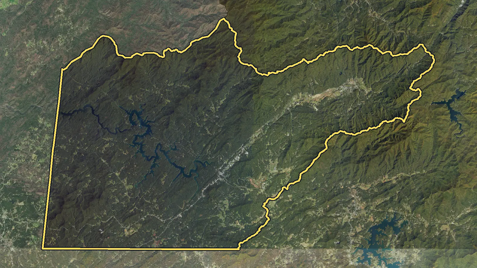
Where we buy
Areas we cover in Cherokee County
These pages cover the largest lot markets in Cherokee County. We buy land anywhere else in the county too: send the parcel details through the form below.
Selling here
How selling land works in Cherokee County
What the countywide parcel figures do and do not show
The North Carolina parcel screen contains 12,140 Cherokee County records passing this project's vacant-lot proxy. The median recorded tract is 1.24 acres, or 54,010 square feet, and mini-estate (2-3 acres)s are the largest size band at 21%. Median county assessed value is $15,000, with the middle half from $8,600–$25,000. Those are county assessment fields used for tax administration, not current sale prices, listings, appraisals or cash offers. The screen does not confirm physical vacancy, a separate legal lot, legal access, a usable building area or utility approval. It also supports no published sale-price median or trend because the approved 2025 qualifying set contains no lot sales. [1]
Permits begin with jurisdiction and the utility plan
Cherokee County Building Code Enforcement administers covered work in county jurisdiction and coordinates applicable floodplain, watershed and special-district rules. The residential checklist requires Environmental Health approval for septic and a well, or approval from the applicable service district, plus zoning approval where one applies and a 911 address. Land disturbance of one acre or more also requires state environmental approval. Because the county describes its authority by jurisdiction, confirm the parcel's jurisdiction before relying on the checklist. Mountain grade, water source, wastewater area, driveway and drainage should be considered together before a house site is assumed. [5],[6],[7]
Deeds, plats and access require primary records
The county GIS is a starting map, not a survey or title report. Cherokee County warns that its layers combine data collected at different scales, dates and definitions and tells users to consult primary deeds, plats and other public records. The Register of Deeds records land instruments and survey plats. County appraisal materials also distinguish state-maintained roads, private paved and gravel roads, private drives and land coded with no legal access, but an appraisal label does not create an easement. Match the tax parcel to the deed and recorded plat, then review rights of way, maintenance duties, gates, grades and whether the route reaches a usable part of the tract. We check utilities, access and title on every parcel before offering. [8],[4],[9]
Selling mountain land before development work
A seller does not have to obtain a building permit, complete septic testing, drill a well, grade a driveway or resolve the buyer's construction design before asking for an offer. Send the parcel number and any deed, survey, plat, access agreement or prior Environmental Health record you already have. We buy vacant lots and land for cash, including lots with no water, sewer or road work. We check utilities, access and title on every parcel before offering. You get a written, no-obligation cash offer within 24 hours. The only contingency is our land inspection, and a failed inspection costs the seller nothing. Closing runs through an independent, licensed title company, typically about 10 days after the purchase agreement is signed, depending on title. There are no fees or commissions, and we cover closing costs.
Step by step
How do I sell my land in Cherokee County?
From your first message to money in hand, with nothing left out. Requesting an offer costs nothing and commits you to nothing.
See every detail of the process-
Tell us about your land
Fill out the short form (about 60 seconds) or email us. A land specialist reaches out to confirm the details, usually the same business day.
-
Get your cash offer within 24 hours
We review the property and send a written, no-obligation cash offer within 24 hours. It is a real number, not a range. Take it or leave it, with no pressure either way.
-
Sign electronically
If you accept, everyone signs the purchase agreement electronically. There is nothing to print or mail at this stage.
-
We inspect, the title company verifies
Our team inspects the land and an independent title company runs a title search for liens or taxes owed. If the land does not pass inspection, you are never charged anything.
-
Close and get paid
The title company prepares the closing documents for notarization and issues your funds by standard check, overnight check, or wire transfer. A typical sale closes in 10 days.
Questions
Selling land in Cherokee County: common questions
Who issues a residential building permit in Cherokee County?
Cherokee County Building Code Enforcement handles permits and inspections in county jurisdiction. The residential checklist also calls for septic and well or service-district approval, a 911 address and zoning approval where applicable. Confirm that the parcel falls within the county's stated jurisdiction before applying.
Where can I verify my deed, survey plat and access rights?
Start with the Cherokee County Register of Deeds for recorded land records and survey plats. Use the deed, plat and easements rather than the GIS line alone, because the county warns that its map combines source material of different dates and accuracy.
Does a mapped mountain road prove legal access?
No. A road visible on GIS or a Forest Service map may be public, private, seasonal, restricted or unrelated to the parcel's deed rights. Confirm a recorded easement, maintenance obligations and physical route before treating the tract as legally accessible.
Can I sell land without septic or well approval?
Yes. Those approvals may be required for future residential construction, but the seller can request an offer with the land in its current condition. Prior site evaluations are helpful. We buy vacant lots and land for cash, including lots with no water, sewer or road work.
Can back taxes or a recorded lien be paid at closing?
Yes. Liens or back taxes can be paid from the sale proceeds at closing, with the seller's consent. Closing runs through an independent, licensed title company, there are no fees or commissions, and we cover closing costs. A deed, estate, access or boundary defect may require additional documents first.
Owner resources
Guides for your situation
- Can You Build on a Vacant Lot?
Maybe. A vacant lot is buildable only if the proposed use fits the rules that apply to that parcel and the site can satisfy access, utility, environmental, and permit requirements. Start with the local planning or zoning office, confirm that the parcel is a legal lot, and get a written parcel-specific answer. A zoning label or tax parcel number alone is not approval to build.[1][2]
- How Cash Land Buyers Price Offers
A cash-land offer may start with verified sales of land with similar use, then adjust those sales for meaningful differences.[1] Buyers may also account for access, utilities, legal use, size, shape, flood and soil questions, title issues, demand, and costs and risk they will carry. No universal assessed-value percentage applies. Compare each written offer by expected net proceeds, contingencies, seller work, and timing—not one asking price or headline number.
- Can You Sell Land With a Lien?
Yes. Land with a lien can often be sold, but signing a deed does not by itself erase a valid claim. The lien may need to be paid, released, discharged, or otherwise resolved under the law that applies. With the seller's consent, an approved payoff can come from sale proceeds at closing. If the balance or lien is wrong, dispute it before closing and require proof of the cure.
Your written offer
Get your cash offer
Four short steps, about 60 seconds. We review your property and send a written, no-obligation cash offer within 24 hours. You can take it or leave it.
What happens after you send this
- A land specialist reaches out, usually the same business day, to confirm the details.
- You get a written cash offer within 24 hours: a real number, not a range.
- You decide. Requesting an offer costs nothing and commits you to nothing.
You will never be asked to pay us anything. No deposit, no processing fee, no closing-cost advance.
How we made this page
Parcel Buyers is a land-buying company based in Florida. We buy vacant land directly from owners and publish these local pages so owners can see what land in their area is doing before they sell, to us or anyone else. We count the tax-roll figures ourselves from state data, take local rules and fees from the official sources listed below, and use AI tools to help research and draft the text. Every number links to its source, and we update the page when the data changes.
Method and sources
Parcel and assessment figures cover all parcels in Cherokee County. Source [1] is our own aggregate count of NC OneMap parcel points or frozen county extracts and the county sale layers named in the source data. Vacant-lot counts use nC has no statewide vacant code. Legacy wave-1 rows retain the frozen county-extract rules in DATA-NOTES-NC.md. The NC2 rule keeps records with improvement value 0, parcel value at least $1,000, known acreage no more than 10, struct not Y, and an owner name that does not match the government, HOA/common-area, church, conservation or utility exclusions. If more than 10% of the pre-struct scope has struct Y, the area uses its verified explicit vacant code or is dropped. Counts do not establish physical vacancy, residential zoning, access, legal-lot status or buildability. Names and addresses are not stored in outputs. Lot sizes use gIS acres on the extract (else record acres, else the parcel polygon area) x 43,560, bucketed with the Parcel Buyers lot sizing chart ([low, high) square feet). Values use county assessed value on the extract from each county's last reappraisal, which is not the same year in every county. Owner locations use owner mailing-address state on the extract; in_state = North Carolina. Junk state codes count as unknown, Canadian provinces as foreign. Onslow's extract carries no mailing state, so Onslow areas report in_state, other_us and foreign as not published (unknown 1.0). Treat medians as a guide to county records, not as an offer or an appraisal. Page updated October 4, 2026. Unit rows are aggregates from tax-roll legal or plat fields. Labels with fewer than 5 records are suppressed, rows with 5–24 records are combined as Other units, and the labels are not official boundaries.
- [1] NC OneMap and county tax offices (data); Parcel Buyers (analysis), NC OneMap statewide parcel points (county tax data), with wave-1 qualified county sale layers (accessed 2026-10-03)
- [2] Cherokee County, North Carolina, Tax Assessor (accessed 2026-10-04)
- [3] Cherokee County Tax Assessor, Real Property Assessment (accessed 2026-10-04)
- [4] Cherokee County, North Carolina, Register of Deeds (accessed 2026-10-04)
- [5] Cherokee County, North Carolina, Building Code Enforcement (accessed 2026-10-04)
- [6] Cherokee County Building Code Enforcement, Residential Permit Requirements (accessed 2026-10-04)
- [7] Cherokee County Health Department, Environmental Health (accessed 2026-10-04)
- [8] Cherokee County, North Carolina, Geographic Information Systems Disclaimer (accessed 2026-10-04)
- [9] Cherokee County Tax Assessor, Cherokee County Real Property Appraisal Manual (accessed 2026-10-04)
- [10] Cherokee County, North Carolina, Watershed Protection Ordinance and Subdivision Regulations (accessed 2026-10-04)
- [11] United States Forest Service, Tusquitee Ranger District Motor Vehicle Use Map (accessed 2026-10-04)